AI Floor Plan Editor for Property Listings
Our floor plan tool turns a rough sketch or property photo into a clean 2D layout graphic you can use in listing and property marketing materials. Upload the layout reference you already have, choose the property category, and we redraw it into a clearer visual plan without making you start from a blank canvas. The workflow covers homes as well as commercial, industrial, hospitality, medical, and educational properties. You get a simple way to present spatial layout without manually rebuilding the plan or commissioning a draftsperson for a marketing graphic.
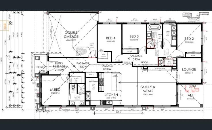
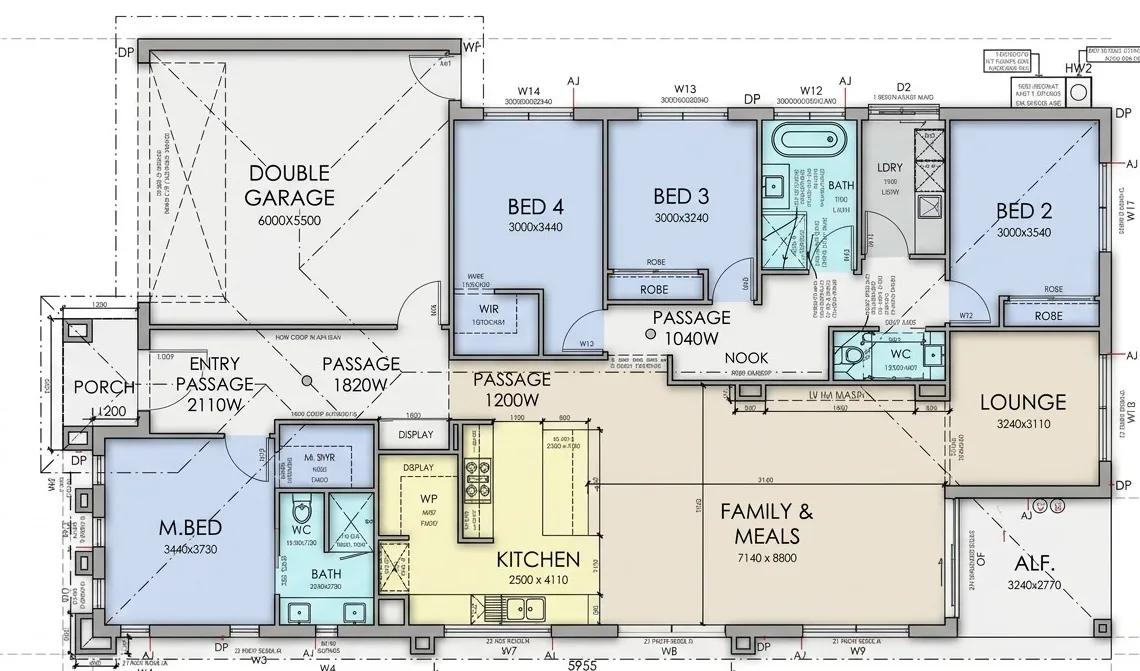
What Is an AI Floor Plan Editor?
AI-assisted floor plan generation converts a rough layout reference - such as a hand-drawn sketch or a photo of the property/unit - into a clean 2D graphic. Instead of tracing the source manually, we use the uploaded image as the layout reference and redraw it into a clearer plan that is easier to use in a property listing, presentation, management record, or marketing campaign. The goal is a readable visual layout, not an architectural redesign of the property.
A good real estate floor plan helps people understand how spaces relate before they inspect the property. It complements listing photography by showing the arrangement from above, while your photos show the rooms themselves. We keep the workflow focused on that job: turn an existing source into a clearer layout visual, then let you review it before publishing.
How to Turn a Sketch or Photo into a 2D Floor Plan
Turning your source into a clean 2D plan takes three straightforward steps:
- 1Upload your source - Add a rough floor plan sketch or a clear photo of the property or unit.
- 2Choose the property type and generate - Select the category that best matches the space so we can process the source in the right context.
- 3Review and download - Check the generated layout against the original property information, then save the graphic for marketing or reference use.
The review matters as much as the redraw. Check room relationships, walls, openings, labels, proportions, and any measurements shown against your original source before you publish. We create a visual plan from the information available in the upload; we do not independently survey the property or verify dimensions on site.
Why a Clear Floor Plan Strengthens a Property Listing
Property photos show finishes and features, but they do not always make the overall arrangement easy to understand. A clean top-down plan adds that missing spatial context. Here’s why agents, property managers, and marketing teams add one to their property media:
- Make the layout easier to understand - Show how rooms and spaces connect in one clear top-down graphic.
- Turn rough references into cleaner marketing assets - Redraw a sketch or source image without manually rebuilding the layout from scratch.
- Support different property sectors - Use the workflow for homes, commercial premises, industrial sites, hospitality venues, healthcare spaces, and educational facilities.
- Keep property information together - Pair the layout graphic with listing photos, descriptions, and other marketing material for a more complete presentation.
- Create a practical reference graphic - Give agents and property managers a visual they can review, share, and use in day-to-day property documentation.
Property Types We Can Turn into 2D Floor Plans
The editor supports six property categories, so the same generation workflow can be used across different real estate and property-management contexts:
- Residential - houses, apartments, townhouses, units, and other residential layouts.
- Commercial and industrial - offices, retail spaces, workspaces, warehouses, and other non-residential properties.
- Hospitality - accommodation and hospitality spaces where a clear layout graphic helps explain room and area relationships.
- Medical and educational - clinics, healthcare spaces, classrooms, training facilities, and other institutional layouts.
Floor Plans, Property Boundaries, and Photo Enhancement
These tools solve different parts of the property-marketing workflow, and choosing the right one keeps the output useful:
- Floor Plan Editor focuses on the interior layout - we turn a sketch or property/unit photo into a clean 2D representation of the space.
- Property Boundary Generator focuses on the site or lot - it creates a boundary map with measurements from a property or site image rather than an interior floor plan.
- AI Real Estate Photo Enhancer focuses on the photography - it improves listing images, while this tool creates a separate layout graphic.
Use this editor when you need to communicate the property’s internal arrangement. Choose the Property Boundary Generator when the important information is the site or lot boundary, and use the Photo Enhancer when the listing photos themselves need improvement. Together, these tools cover different visual layers of a property campaign without treating one graphic as a substitute for another.
Inputs & Outputs
Keep Your Floor Plans Accurate
- Our generated floor plans are built for visual marketing and reference, not for legal, contractual, surveying, architectural, or construction decisions. Output quality depends on how clearly the uploaded sketch or photo represents the real layout. Before publishing, compare the result with the source and verify room names, spatial relationships, openings, proportions, and any dimensions or measurements shown. If you need certified measurements or a legally reliable plan, use a licensed surveyor, draftsperson, or other appropriately qualified professional.
Frequently Asked Questions
What is an AI floor plan editor?
An AI floor plan editor takes an existing sketch or property/unit image and redraws it as a clearer 2D layout graphic. We use it to make source material easier to present in real estate marketing and day-to-day property documentation.
Can I create a floor plan from a photo instead of a sketch?
Yes. Enhancia accepts either a rough sketch or a photo of the property or unit as the source. A clear, well-framed input gives the AI a stronger layout reference to work from.
What property types does the AI Floor Plan Editor support?
Residential, commercial, and industrial properties are supported, along with hospitality, medical, and educational spaces. Choose the category that best matches the property before generation.
Is an AI-generated floor plan a certified survey?
No. The output is an AI-generated 2D visual for marketing and reference. It is not a certified survey, architectural drawing, or legally binding measurement document. Verify dimensions independently when accuracy is critical.
What is the difference between a floor plan and a property boundary map?
A floor plan communicates the internal arrangement of rooms and spaces. A property boundary map focuses on the site or lot. Enhancia provides a separate Property Boundary Generator for site-level boundary graphics.
Do I need floor plan or drafting software experience?
No specialist drafting workflow is required. Upload your source, select the relevant property category, generate the plan, and review the result. You should still check the final graphic carefully against the actual property before using it.
Related Tools
Property Boundary Generator
Generate a property boundary map with measurements from a photo.
AI Real Estate Photo Enhancer
Our AI real estate photo enhancer gives you targeted control over the issues that make listing photos feel unfinished. Upload a property image, choose the edit it actually needs, and we improve that specific part of the photo — from colour and white balance to perspective, sky, clutter, facade presentation, or resolution. Instead of pushing one generic filter across the whole image, we help you refine the photo in focused passes, review the result, and keep building toward a clean, listing-ready finish.
More resources
Read related guides in the Enhancia Knowledge Base, or see full pricing details on the pricing page.